The middle course of a river is mainly characterised by lateral erosion with some vertical erosion along the course. This widens the river to a U shaped profile.
The flow is less turbulent compared to the upper course. The river will be flowing along relatively flat terrains. River deposition usually starts in the middle course.
What are the Features of the Middle Course?
Meanders and Ox-Bow Lakes
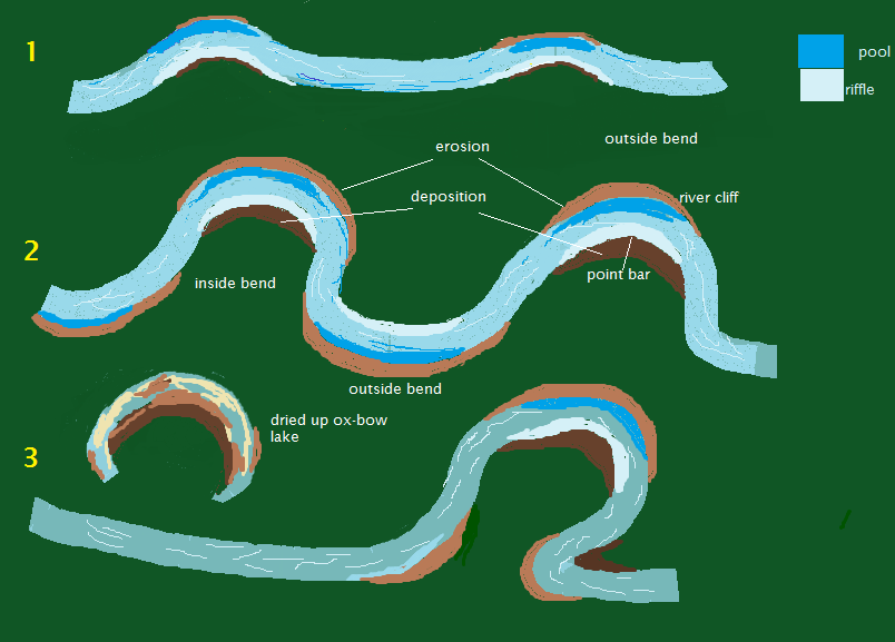
Perhaps the most noticeable feature in the middle course is a river meander. Meanders are a result of both erosion and deposition.
Meanders start when there is deposition in the small inner bends of a river and erosion on the outer bends. River flow is fastest on the outer bends resulting in higher erosion rates.
While material is deposited on the inner bend, the outer bend is eroded further and extended eventually creating an S shape appearance. The deposited material creates a slip of slope or point bar while a river cliff is created on the outside bend.
As more and more erosion progresses on the outside bend, the river eventually cuts off the bend preventing the longer route around creating an Ox-Bow Lake.

Meanders can be considered middle or lower course features as erosion and deposition is required for their formation
Pool and Riffle
A pool is deeper section along a river usually found on the outside bends of meanders where erosion is active. Conversely, a riffle is a shallower section on the inside bend of a meander where there is deposition.
Incised Meanders
Incised meanders are gorge like landforms formed when a meander erodes down soft stratum. Usually, these form when a meander is rejuvenated by tectonic activities such as faulting which causes the river to erode more vertically.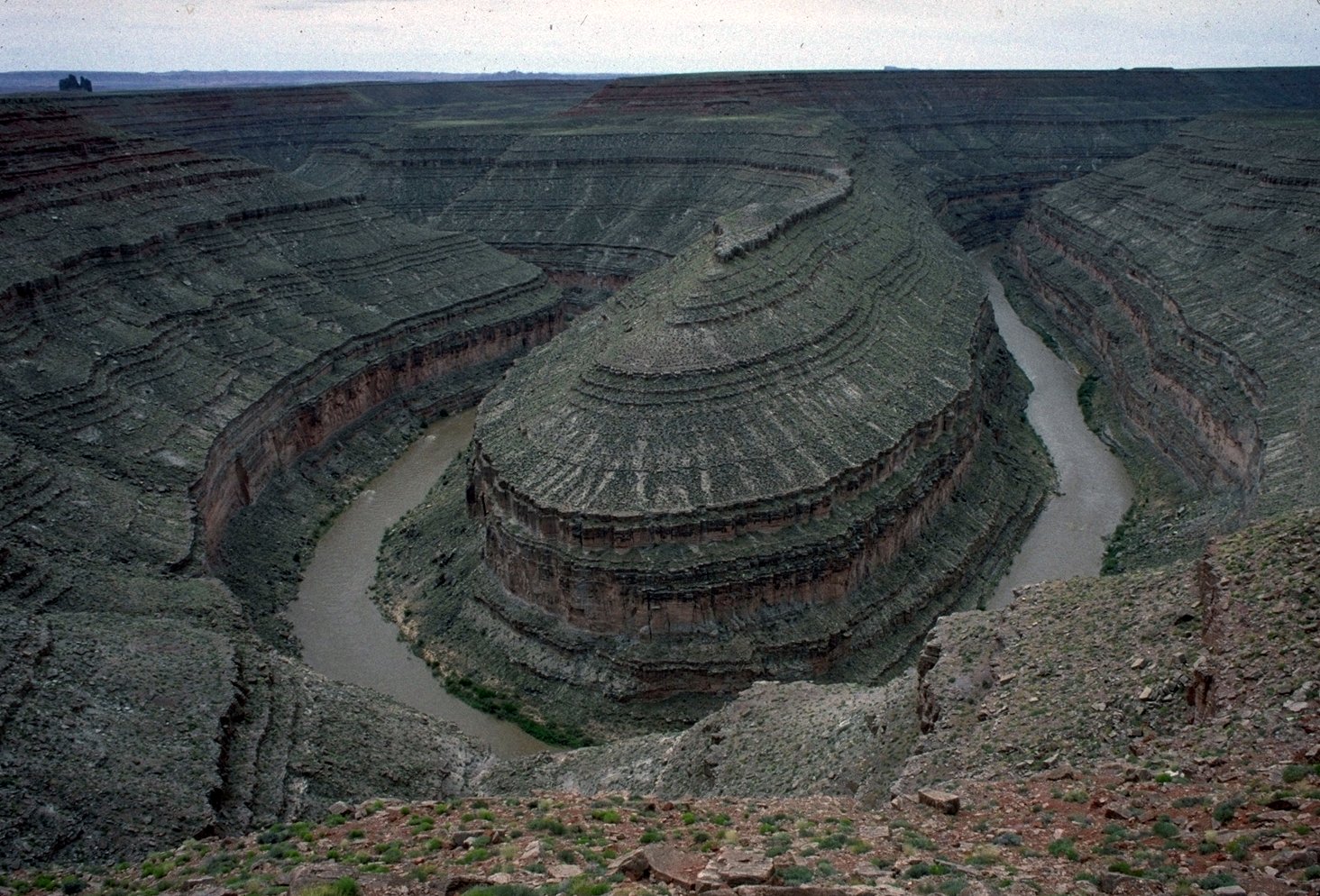
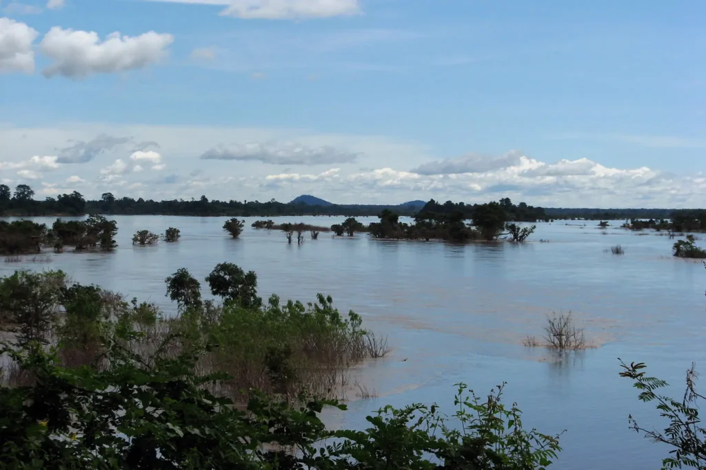
Floodplains
A floodplain is an a area of land on which a river overspills or floods on. It is usually characterised by nutrient rich alluvium soils.
What are the Benefits of Floodplains?
Floodplains have some economical value to them.
- They provide fertile soils for farming, e.g rice.
- Recreational activities, e.g bird watching, fishing etc
- Replenish ground water sources.
- Controls and reduce floods as abundant vegetation promotes infiltration.
- Reduces erosion and runoff due to abundant vegetation which captures the moving water.
- Provides a natural habitat for wildlife.
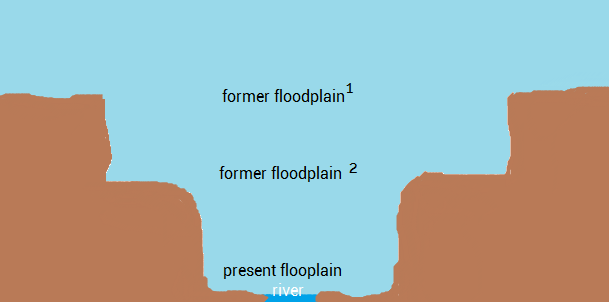
River Terraces
Terraces are step-like remnants of previous flood plains. Most terraces are as a result of both lateral and vertical erosion. Vertical erosion first cuts down overlying stratum forming V shaped valleys. Lateral erosion, usually by meanders, then widens these valleys forming a floodplain.
Rejuvenation causes further down cutting leaving the former floodplain (valley floor) above. The process continues creating a staircase valley. Terraces can be found in the upper course but more often in the middle course where lateral erosion create floodplains that are then eroded vertically.
If lateral erosion is more pronounced than vertical erosion such that one valley side is eroded further and removed, unpaired terraces form which are asymmetrical on either side.